North Country Trail Association

Central New York Chapter

Section

Northern terminus of the Link Trail west of Tuscarora Lake to the Oneida/Herkimer county line

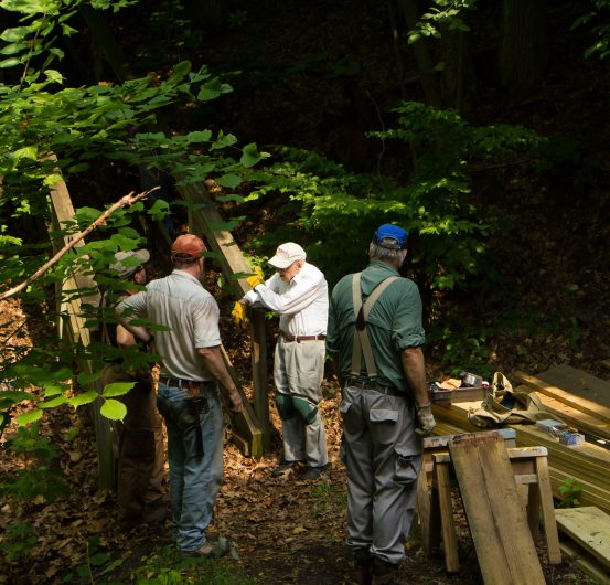
The Central New York Chapter of the North Country Trail Association has approximately 140 members. We are passionate about maintaining the NCNST to an excellent condition for hikers, and providing interpretive experiences on the Trail through our recreational hikes and activities. By exploring, building, and maintaining the NCNST and the Link Trail in Central New York we play a significant role in building a part of America’s longest hiking trail. One of our goals is to attract and retain membership, both in terms of number and diversity. Volunteers are a major element of the North Country Trail and Link Trail. There are volunteer jobs in administration or in the field. On the Trail, volunteers build, relocate and design trail sections, build and repair trail structures, and install trail markers and signage. Volunteers can join route scouting committees, become Trail Adopters, organize events or lead hikes. Volunteers assist year-round in all areas: Publications, fundraising, grant writing, membership development and more. Please join and volunteer with us!

kety DataKey Data

Chapter Trail Section

In New York State, the North Country Trail begins at the PA/NY line in Allegany State Park. Traversing the state, it overlays the Finger Lakes Trail, the Onondaga Trail, the Link Trail, and the Old Erie Canal State Historic Park Towpath Trail to Rome. Within the City of Rome, planning is underway to provide a trail northward to Lake Delta along the Mohawk River Walk route and traversing Griffiss Land Development and Art Park. The proposed trail continues from Floyd through Clark Hill State Forest to Pixley Falls State Park. (The current routing simply follows the highway, NYS Route 46, from Rome to Pixley Falls). Here it joins the Black River Environmental Improvement Association (BREIA) Black River Canal Trail from Pixley Falls to Boonville. Then the Black River Feeder Canal Towpath carries the NCNST to Forestport. It continues through the Adirondack Park to the Vermont/New York State Line.

The Central New York Chapter has primary responsibility for coordination and maintenance of the Trail route from the Tioughnioga Wildlife Management Area as it continues north through Nelson Swamp Unique Area; Stone Quarry Hill Art Park near Cazenovia; the Village of Cazenovia with its historic homes, shops, restaurants, and Lorenzo State Historic Site; Chittenango Falls State Park (via a future side trail) and the Old Erie Canal State Historic Park at Canastota. From Canastota, the Central New York Chapter coordinates with other NCNST stakeholders who do their part to maintain the Trail northeast through Rome, Pixley Falls State Park and Booneville, thence east to Forestport to the Adirondack Park “Blue Line.”

Trail Town: Canastota

Canastota is a quaint village in central New York, located in the geographic corridor between the Mohawk Valley and Oneida Lake. The North Country Trail passes through downtown Canastota, offering resupply opportunities for long distance hikers as well as many options for day hikers finding their adventure right nearby.

Connect and Get Involved

Join the Chapter
cny@northcountrytrail.org
Facebook
Chapter Meetup

Resources

Use the Report Trail Condition form to alert NCTA and the Chapter to poor trail conditions. Visit the Trail Alerts page while planning your adventure.

Suggested Hikes

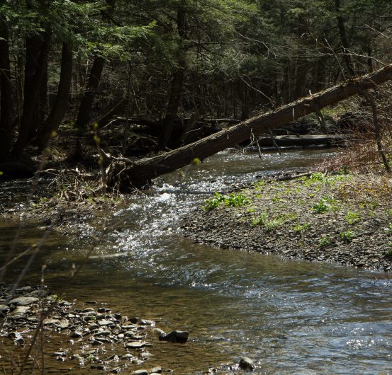
Nelson Swamp Unique Area, Constine Bridge Road to Hardscrabble Road: 1.7 miles one-way, easy (with one steep bank). The Link Trail/NCNST follows an old rail bed through a mixed cedar and hemlock forest and then crosses a footbridge over Chittenango Creek. Grassland/low bushes offer wildflowers and bird watching. After a second wooded section, follow hedgerows/fields to Hardscrabble Road. The Department of Environmental Conservation (DEC) has also built and maintains an Interpretive Loop Trail (0.7 miles), handicapped accessible. From Constine Bridge Road trailhead, follow Link Trail/NCNST to begin the Loop Trail through cedar and hemlock forest along Chittenango Creek and alongside a meadow before looping back to the Link Trail/NCNST.

Stone Quarry Hill Art Park (SQHAP): 1.9 miles, easy to moderate. Find the blue blazes of the Link Trail/NCNST near the parking area at the top of the hill. Follow the blue blazes west and north through woods, beside a small stream, through hedgerows with short open spaces, and into a mixed hemlock/hardwoods grove out to trailhead parking on Chenango Street at the edge of Cazenovia Village. Car parking is available at both sites. Also, SQHAP appreciates donations from non-members.

Quarry Road to Mount Pleasant Street / Route 5, Canastota: 6.3 miles, mostly level hiking (with one short, steep downhill and a climb up a 72-step stairway). One of the newest sections of the Link Trail/NCNST on an abandoned railbed with valley views, creek and wetlands on both sides of the Trail; continue through a scenic ravine with views of Canastota Creek. Climb out of the ravine via a stairway and continue through hardwoods.

Cazenovia to Freber Road / Chittenango Falls State Park: 7 miles, mostly level hike. Walk from Gissen’s Photography Studio in Cazenovia along forested abandoned Lehigh Valley Railroad bed, along scenic Chittenango Creek.

BREIA / Black River Canal Trail: 6 miles, easy, level walk. Connects Pixley Falls Park to Boonville Walk past historic lock, Boonville Canal Museum with replica canal boat, sometimes through State Park gorge. This is the NCT’s approach to the Adirondacks.

Chapter Maps and Guidance

View our section of the Trail on the interactive online map

Additional Local Resources

Finger Lakes Trail
North Country “Toe” Path Trekkers Walk-Run Club (Boonville, NY)
Adirondack Park Agency
New York State Department of Conservation
Hugh Yeman’s Link Trail blog
Erie Canal Bike Path