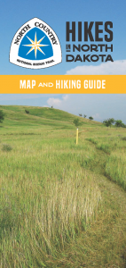
More than 460 miles of the North Country National Scenic Trail traverse North Dakota.
Watch the wind ripple the prairies, roam across cattle pastures and over sand hills, and savor the shade of oak savannas. Gaze across the river valleys and traverse ridges of former glacial lakes. Follow historic routes of those who went west after the Civil War. Stand at the westernmost end of the longest National Scenic Trail in America.
The trail crosses a variety of notable land units and features in North Dakota, including Lake Sakakawea State Park, Lonetree Wildlife Management Area, Audubon National Wildlife Refuge, Lake Ashtabula Recreation Area, the Garrison Diversion Project, Fort Ransom State Park, Sheyenne State Forest, the Sheyenne River, Sheyenne National Grassland, the Ekre Grassland Preserve, and Fort Abercrombie State Historic Site.
North Dakota’s North Country Trail is maintained predominantly by the volunteers of three NCTA Chapters:
The state also hosts two official NCTA Trail Towns: Lisbon and Abercrombie.
Additional Information
- Suggested Hikes Fact Sheets (updated March 2022)
- North Dakota Tourism
- A vehicular entrance pass is required for North Dakota State Parks.
- Trail users may experience extreme weather conditions in North Dakota, particularly in the summer and winter.
- The trail’s route through North Dakota offers limited shelter and water options. Camping is available at designated sites along the trail and in some towns. Dispersed camping can take place on most federal and state-owned land, other than state parks. Camping is not allowed within Audubon National Wildlife Refuge.
- Some trail sections feature fence stiles that require climbing over.
Header photo by Dove Day

