Our Stories
Western Terminus: Trail Section Highlight
Categories: North Dakota
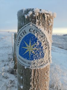
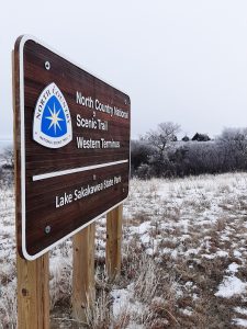
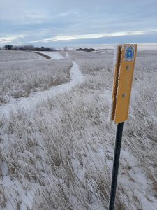
If you know the North Country Trail, you know the Western Terminus is located in Lake Sakakawea State Park in North Dakota, but there are a number of additional features and attractions to explore nearby. Improve your NCT (and North Dakota) knowledge and plan your next adventure!
- The Missouri River is over 2,300 miles in length from Montana to St. Louis. Lewis and Clark passed through the Lake Sakakawea area in 1805 on their way west, and again in 1806 on their return trip east.
Matt Davis - Did you know Lake Sakakawea is the second largest man-made lake in size within the U.S.? Created in 1954 with the completion of the Garrison Dam (U.S. Army Corps of Engineers), it’s 178 miles long and averages between two and three miles wide, though it reaches a maximum width of 14 miles. Sadly, creation of the lake displaced most of the productive farmland of the Three Affiliated Tribes and forced the relocation of thousands of Native Americans – many to New Town, ND which replaced a couple of communities inundated by the reservoir.
- The nearly 15,000-acre Audubon National Wildlife Refuge hosts some of the newest miles of the NCT. (Volunteers interested in furthering these efforts should contact the Regional Trail Coordinator for North Dakota, Matt Davis, at mdavis@nrothcountrytrail.org!) It was originally designated as the Snake Creek National Wildlife Refuge in 1955, but renamed in 1967 for the artist and naturalist, John James Audubon. He passed through the area is the mid-1800’s and chronicled birds (246 have been observed in the refuge) and mammals for his future books. The area is known for migratory birds and shorebirds.
- The Garrison Dam is the largest of six main stem dams on the Missouri River authorized by the Flood Control Act of 1944. At over two miles long, its the fifth largest earthen dam in the world. It can produce enough electricity to power 360,000 homes. The power plant is open for tours.
Matt Davis - The Garrison Dam National Fish Hatchery is located below the dam, and is the world’s largest walleye and northern pike producing hatchery. The U.S. Fish & Wildlife Service also works at the hatchery to restore endangered riverine fish species like the pallid sturgeon.
- The City of Riverdale (pop. 225), which the NCT currently runs right through, was the “company town” created by the U.S. Army Corps of Engineers in 1946. It remained a federally owned town until 1986 when it became North Dakota’s newest city. The high school is now run as a hotel.
- At the east end of Lake Audubon is the outlet and start of the McClusky Canal, which the NCT follows for the next 70+ miles. The canal is part of the Garrison Diversion federal water project, whose original purpose was to mitigate for North Dakota agricultural land flooded by Lake Sakakawea by providing water for irrigation projects. The Lonetree Wildlife Management Area, which hosts a 32-mile segment of the NCT, was supposed to be a storage reservoir in between the McClusky and New Rockford Canal segments. The project stalled in the 1980’s and has been reformulated to deliver water to cities in eastern North Dakota. All of the canals’ structures are maintained by the Garrison Diversion Conservancy District.